


For most professionals considering a move, the concept of a “commute” usually conjures images of brake lights, stress, and lost time. In many metropolitan areas, the distance between home and work is measured in frustration rather than miles.
But in the Inland Northwest, and specifically for residents of The Trails community in Coeur d’Alene, the morning journey looks different. It isn’t just about getting from Point A to Point B; it’s about how your environment shapes the start and end of your day. Whether you are a healthcare professional at Kootenai Health, an engineer in Post Falls, or a tech worker in Spokane Valley, understanding the logistics of the region is the first step toward reclaiming your time.
This guide moves beyond simple mileage estimates to help you understand the flow of traffic, the reality of seasonal weather, and the surprisingly robust alternative transportation options available to you.
The Geography of Opportunity
To understand your potential commute, first orient yourself within the region’s geography. The Trails is located in Coeur d’Alene along Coeur Terre Boulevard, positioned between downtown Coeur d’Alene and Post Falls. Its location provides a planning advantage: it avoids many of the narrow city streets found in older neighborhoods while maintaining convenient access to major arterial roads that connect with Interstate 90 and the broader regional network.
Unlike older developments that require navigating congested local roads to reach freeways, The Trails was designed with modern connectivity in mind, making it easier for residents to access key regional employment and activity centers including downtown Coeur d’Alene, the Post Falls area, and the Spokane Valley.
Analyzing Your Route: Times, Distances, and Employers
Understanding Regional Access and Commuting
When evaluating a new home, many buyers begin by looking at a map. Understanding how a location connects to surrounding communities and employment centers, however, requires a clearer view of the regional road network and how the area is laid out.
The Trails, located along Coeur Terre Boulevard in Coeur d’Alene, is positioned within a well-established north Idaho transportation corridor. The community is served by multiple arterial roads that connect directly to Coeur d’Alene, Post Falls, and the broader Interstate 90 system.
Local Access: Coeur d’Alene
Primary access to central Coeur d’Alene is provided via Atlas Road, Huetter Road, and Ramsey Road, which link residential areas to medical facilities, retail centers, and downtown destinations. Many local destinations can be reached using city and county roads without reliance on the interstate.
Regional Access: Post Falls
Travel between Coeur d’Alene and Post Falls is supported by east–west arterials such as Prairie Avenue, as well as north–south connections including Highway 41. These routes connect residential areas with Post Falls’ commercial and industrial districts and provide alternatives to interstate travel depending on destination and conditions.
Interstate Connectivity: Spokane Valley
For destinations beyond North Idaho, Interstate 90 serves as the primary regional corridor. I-90 provides direct access west to Spokane Valley and Liberty Lake, and east toward the Silver Valley and western Montana. This interstate connection supports daily commuting as well as regional travel.
Summary
The Trails benefits from a location that combines neighborhood-scale access with proximity to major transportation routes. Multiple arterial roads and nearby interstate connectivity allow residents to reach Coeur d’Alene, Post Falls, and Spokane Valley using established regional infrastructure.
Frequently Asked Questions
Q: Is the traffic on I-90 comparable to big city traffic?A: Generally, no. While “rush hour” exists, it typically involves slowing down rather than stopping completely. The exception is summer Friday afternoons when tourist traffic increases volume.
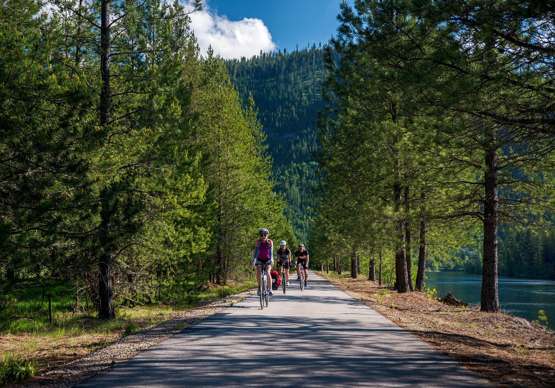
Q: Can I really bike to work in Post Falls from The Trails?A: Yes. The Prairie Trail offers a paved, separated path that runs parallel to the road. It is safe, flat, and widely used by commuters, removing the danger of riding on the shoulder of a highway.
Q: How does the location of The Trails impact commute costs?A: By providing easy access to surface streets like Prairie Avenue and Ramsey Road, residents can often avoid the “stop-and-go” fuel consumption of city center driving. Additionally, the viability of cycling for half the year can significantly reduce annual vehicle wear and tear.
The Verdict: Quality of Life as a Metric
Ultimately, calculating a commute isn’t just about minutes; it’s about the quality of those minutes. Living in The Trails offers a rare balance: you are secluded enough to enjoy the quiet of a master-planned community and the beauty of the prairie, yet connected enough to reach three major cities in under 30 minutes.
Whether you are driving past mountain vistas on I-90 or pedaling down the Prairie Trail, the commute here is designed to be a transition—not a burden.
If you are exploring a move to the area, we encourage you to drive these routes yourself. Experience the flow of traffic and see how the strategic location of The Trails can turn a daily obligation into a manageable part of your lifestyle.